Western Fire Resources offers comprehensive GIS mapping services that support wildfire planning, land management, and operational decision‑making. Our mapping products include fire behavior and fuels treatment maps, fire history maps, evacuation and access maps, and detailed facility maps for agencies and private organizations. Beyond fire, we also produce high‑quality ranch maps and custom hunting maps that integrate terrain, vegetation, water sources, and access routes. Whether the need is strategic planning, incident support, or land‑use management, our GIS products provide clear, accurate, and actionable spatial information tailored to each client’s objectives.
GIS Mapping Services
Operational Land-Use Maps
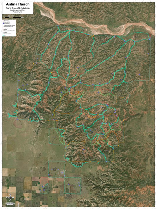
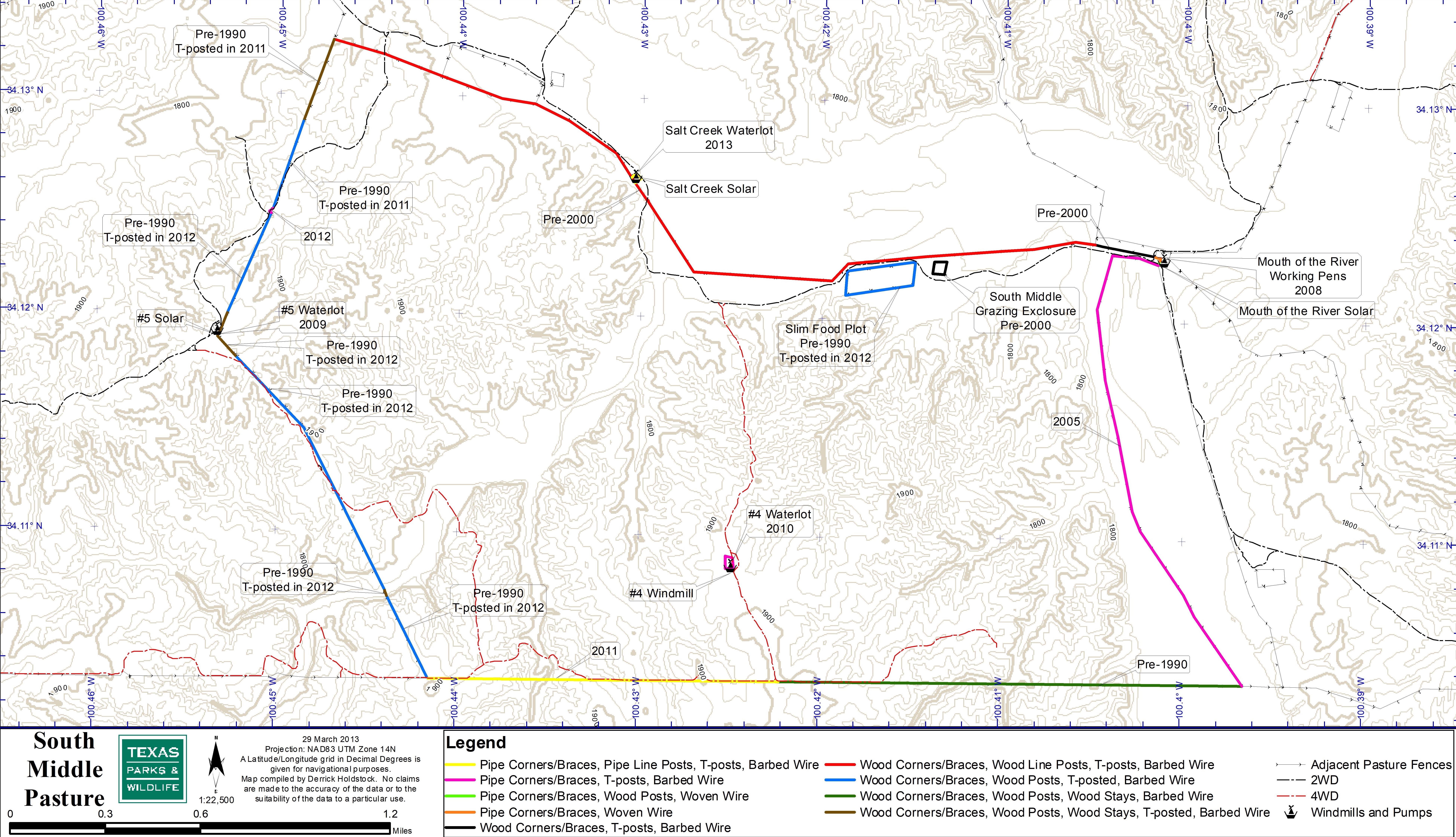
Large ranches, hunt units, and rural properties often lack clear, up‑to‑date maps showing pastures, water sources, legal boundaries, access routes, and terrain features needed for daily operations and safe field use. We produce detailed operational maps that integrate ownership boundaries, roads, trails, gates, and critical infrastructure into a single, accurate spatial picture to support planning, navigation, and emergency response.
Facilities and Infrastructure Maps
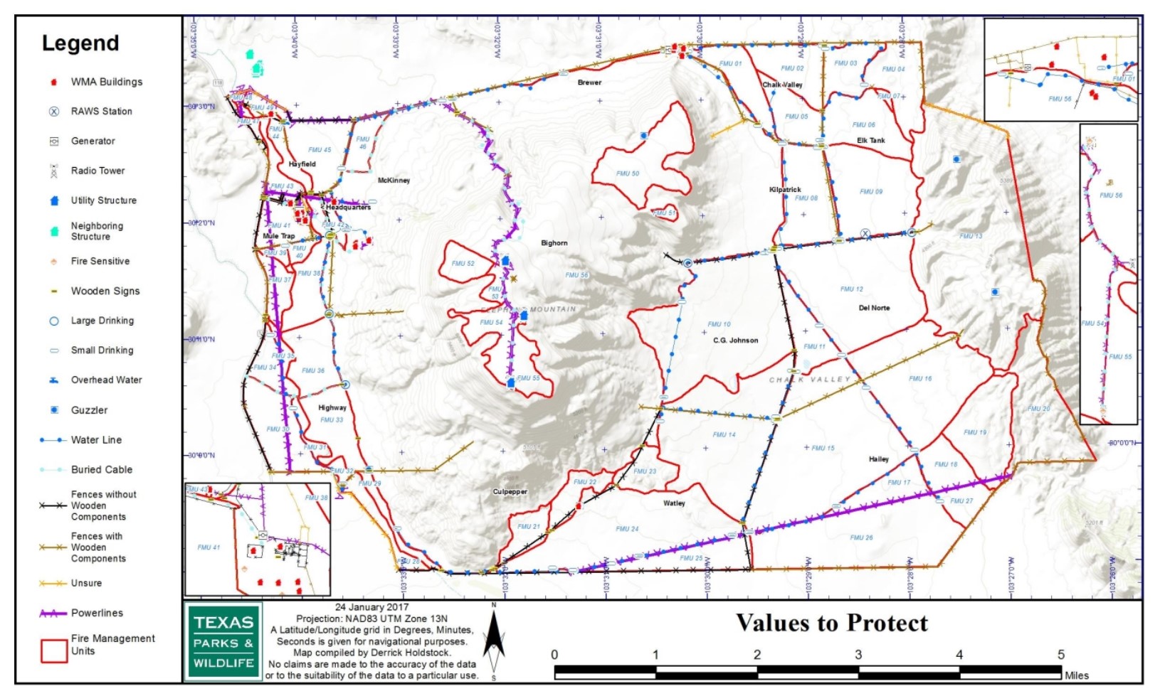
Precise knowledge of buildings, roads, pipelines, powerlines, and other infrastructure is essential for routine operations, maintenance, and wildfire response. We create clear, accurate maps that depict facilities and critical infrastructure so landowners and responders can plan, maintain, and protect key assets.
Community Evacuation and Values-at-Risk Maps
Communities need clearly defined evacuation routes, muster points, and an understanding of nearby values at risk to act quickly and safely during a wildfire. We develop evacuation and muster‑point maps showing primary and alternate routes, assembly locations, and key landmarks, along with detailed structure location and values‑at‑risk maps that support pre‑season planning and real‑time incident decision‑making.
Past Fuels Treatment Maps
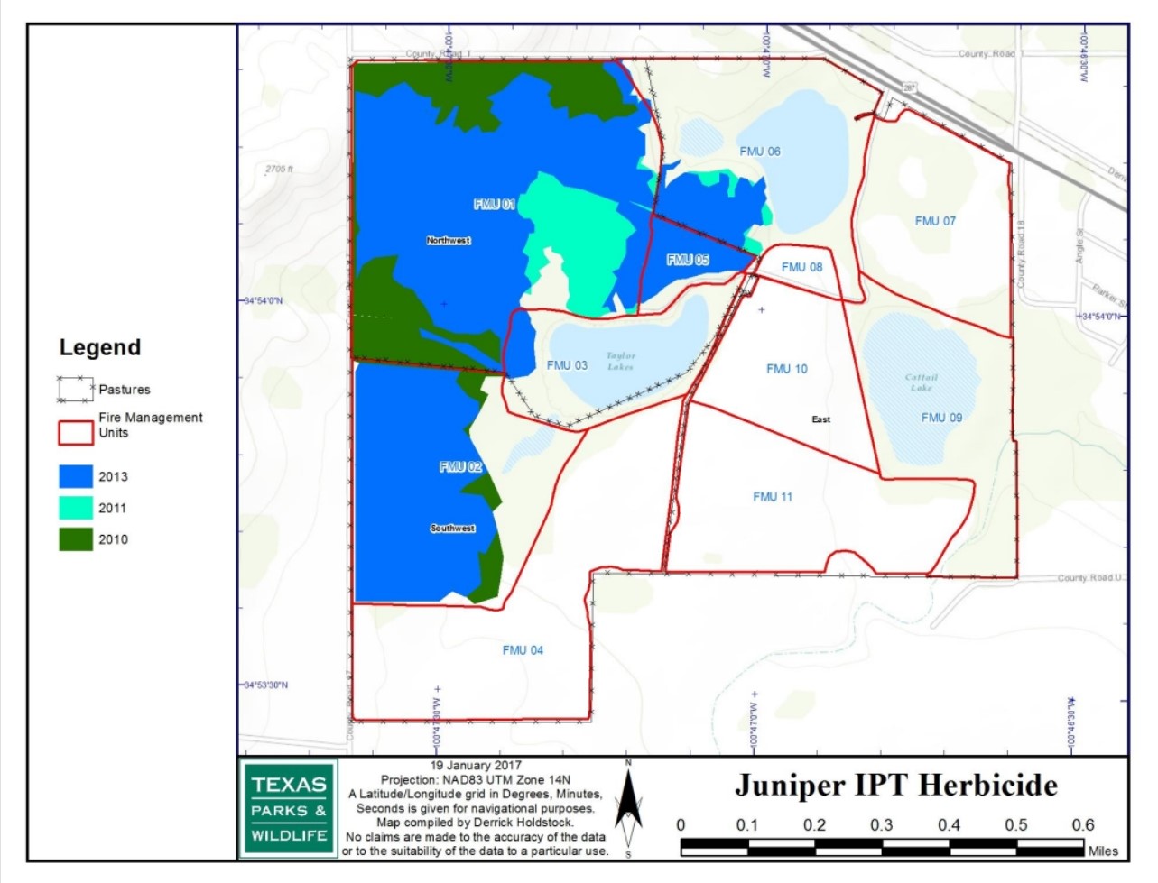
Knowing where fuels treatments have already been completed helps landowners avoid duplication, plan future work, and give fire departments critical information about existing fuel breaks and thinned areas. We compile past treatment data into field‑ready maps so responding resources can quickly orient themselves and take advantage of completed work during an incident.
Past Fire History and Severity Maps
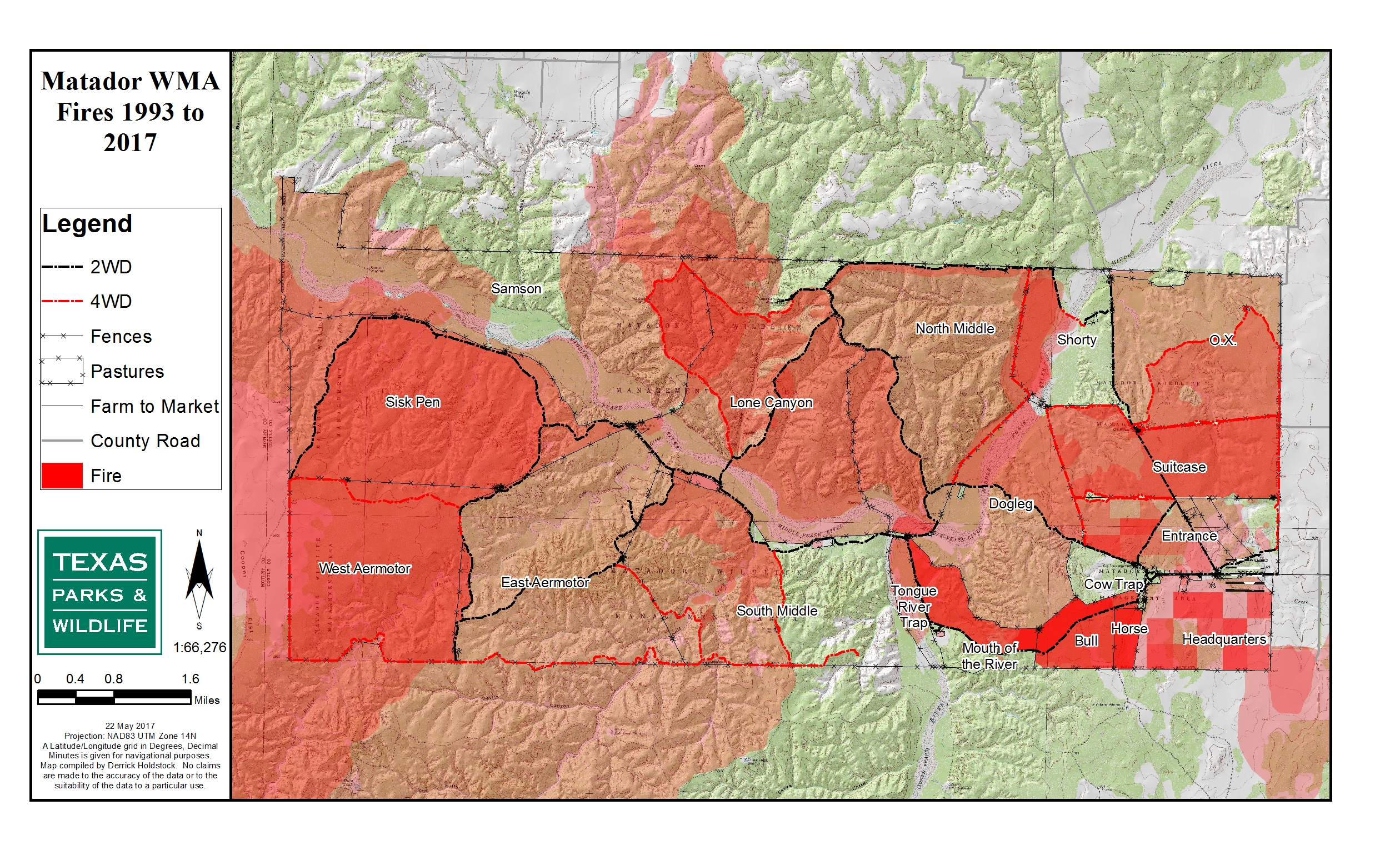
Understanding where past fires burned—and how severely—provides essential insight for risk assessment, recovery planning, and future treatment priorities. We produce detailed fire‑history and burn‑severity maps that display historical perimeters, severity patterns, and related ecological data, helping landowners and agencies make informed, defensible management decisions.
Western Fire Resources is currently seeking an Engine Captain for the 2027 wildfire season. See the Employment section for the vacancy announcement.