When assessing wildfire risk, the combination of factors that affect fire behavior can be confusing because these factors vary both spatially and temporarily. We work with real-world scenarios important to our customers to generate our wildfire risk assessments.
We begin by researching the local fire environment in order to select realistic high-end combinations of fire weather parameters to model. We then access fuels datasets containing fuel type, height, cover, and density data, and overlay them on a digital elevation model to account for elevation, slope, and aspect. Next, we condition fuels pixel by pixel across the landscape based upon weather parameters, shading, aspect, and position on slope. This gives us beginning fuel moistures for each pixel. For each wind direction and wind speed combination selected, we utilize a fluid dynamics model to create a wind vector grid that accounts for the spatial effects of canopy cover, topography, and diurnal effects of buoyancy. We then simulate tens of thousands of ignitions to estimate average values of such outputs as flame length, rate of spread, fireline intensity, burn probability, crown fire activity (crown vs. surface fire), crown fraction burned, and maximum spotting distance.
These simulations are very helpful in identifying where the risk from a wildfire would be highest under a given situation, what kind of fire behavior could be expected at any point on the landscape, and where fuels treatments may be necessary. Another product offered is a fire spread animation. This, along with static maps, provide a very visual representation of potential fire behavior and wildfire risk that can be used to inform homeowners of risks to individual properties and to inform municipalities on where community actions could protect the entire community from the effects of wildfire.
Examples of Risk Assessment Maps
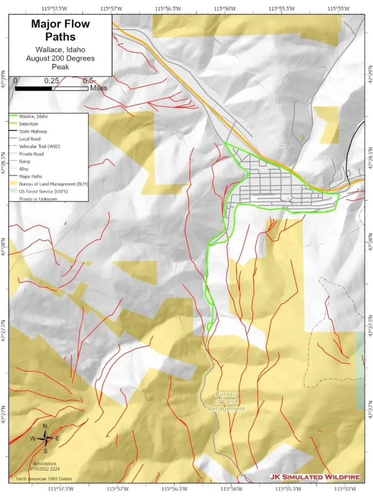
One of the most powerful assessments we can model is the identification of major fire flow paths. These are the routes most often taken by wildfires when 10,000 or so random ignitions are modelled. These help us to identify the most effective locations for fuels treatments.
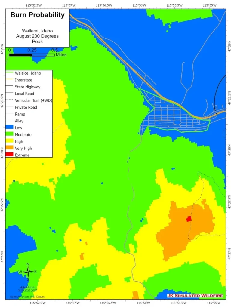
We can estimate burn probability based upon 10,000 or more random ignitions across a landscape.
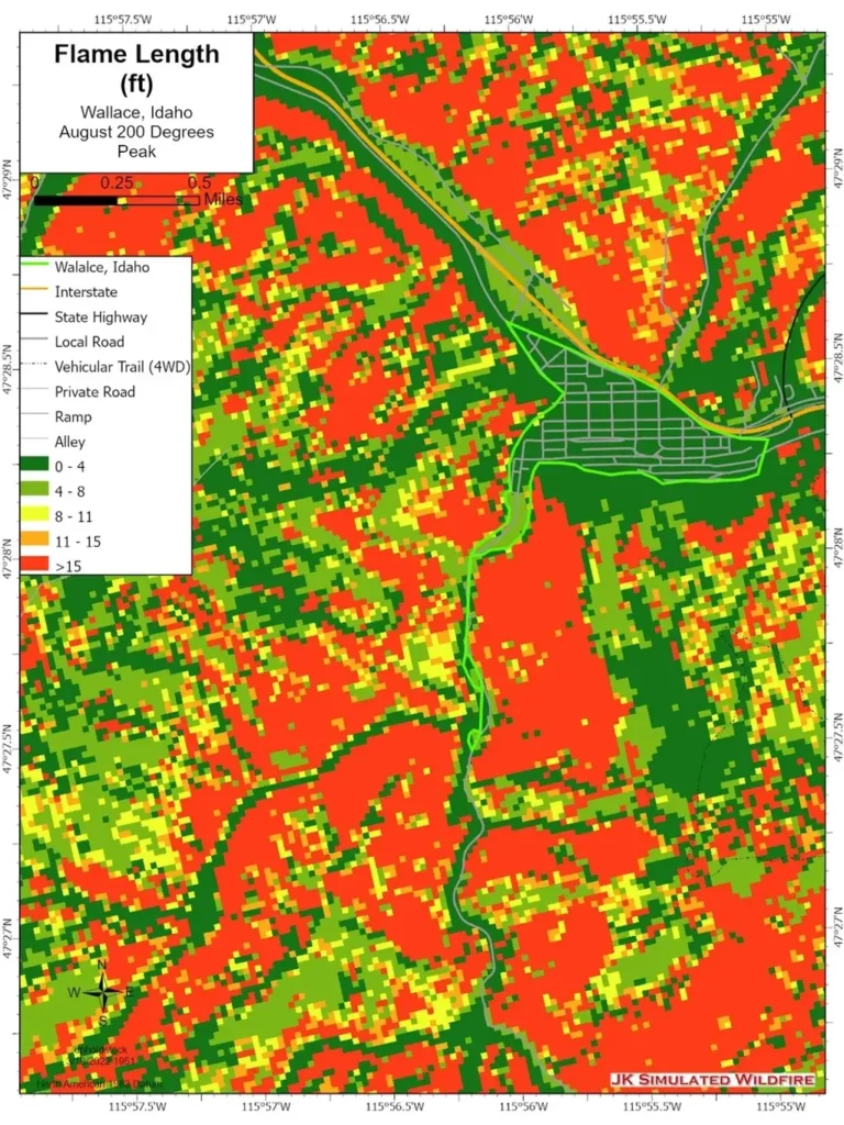
Flame length is one of the most important factors considered when determining what resources will be effective. In general, hand crews are effective when the flame length at the head is 0-4 feet. Dozers, engines, and aircraft can be effective when flame length is between 4 and 8 feet. Control efforts at the head are most likely ineffective when flame lengths are 8 feet or greater.
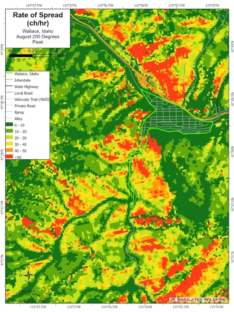
Rate of spread is an important factor to consider when determining how much time is required to evacuate a community or to dispatch and engage a suppression response.
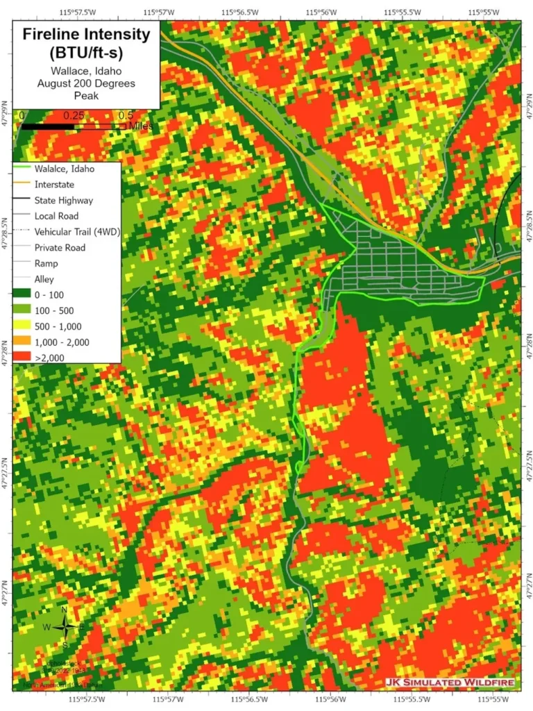
Fireline intensity is related to the flame length and rate of spread, but is most helpful in predicting the effects a fire may have on vegetation and human values. A fire that passes with less intensity will result in less plant mortality and less damage to human values than a fire that passes with more intensity.
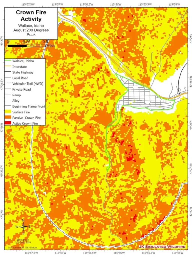
Areas where passive crown fires (single tree or group torching) or active crown fires (running crown fire) are predicted will create elevated ember sources which could carry firebrands over firelines and holding resources, and create spot fires ahead of the main fire. Minimizing passive and active crown fires upwind of values at risk is a solid strategy in protecting homes and communities.
